Socioeconomic Index for Small Areas (SEISA) - Wales map
SEISA is a UK-wide area-based measure of deprivation first developed by HESA in 2021
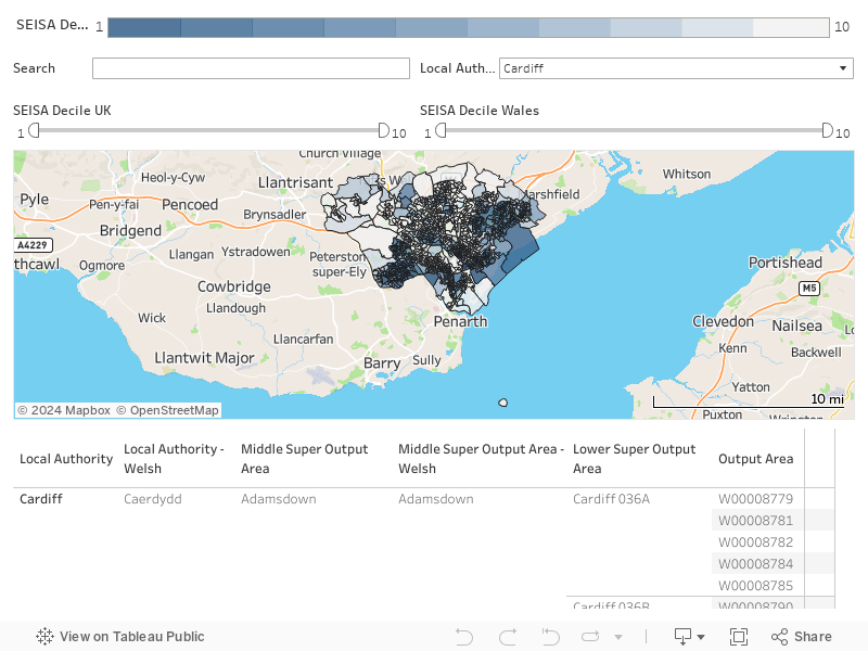
For help using the map please see the video below.
Using the maps
Skip to: Dashboard basics (0:05) | Filters (3:00) | Search (5:35) | Map tools (7:48) | Table (11:44) | Troubleshooting (15:45) | Download video transcript (.txt)
The free text search field allows you to search for specific geographic areas.
Valid search entries
You can search for either local authority, middle super output area, lower super output area, output area codes or postcodes (with or without a space).
All geographies can be searched by their name or code (except for output area which only has a code).
You can also search for local authority and middle super output area names in Welsh.
This table illustrates a list of valid search entries for Wales. An invalid entry will result in a blank error screen.
| Valid Entry Type | Name example | Code example |
|---|---|---|
| Local Authority | Cardiff/Caerdydd | W06000015 |
| Middle Super Output Area | Butetown/Tre-biwt | W02000423 |
| Lower Super Output Area | Cardiff 049A | W01001699 |
| Output Area | W00008814 | |
| Postcode | CF10 3AT |
Invalid search entries
If you use the search function, and you receive a blank screen, this means that you have searched an invalid item. For example, if you search for a university name, you will receive a blank screen as this is not an accepted search item. Examples of invalid entries are provided in the table below (please note that this is not an exhaustive list).
Please also note that there may be instances where searching for an invalid geography type may still lead to a valid search emerging. This may occur in instances where the name you have searched for overlaps with an accepted geography type. We recommend checking that the area displayed aligns with your expectations.
| Invalid entries | Example |
|---|---|
| University Names | University of South Wales |
| School Names | Ysgol Bro Preseli |
| Street Names | Aber Street |
| Parliamentary Constituencies | Brecon and Radnorshire |
| Built-up areas | Abertridwr and Senghenydd |
| NHS Health Boards and Trusts | Betsi Cadwaladr University Health Board |
| Electoral wards | Eglwysbach |
| Travel to work areas | Tywyn and Dolgellau |
| Communities | Aberffraw |
| Country | Wales |
In the tooltips and tables, you will see two decile columns. One of these is a UK-wide field, while the other is a country-specific variable. The decile you should use/refer to when exploring the maps or in any onward examination you conduct with the data (e.g. when using the ‘SEISA dataset’ on the ‘SEISA resources’ webpage) shall depend on the nature of your analysis. Below, we have supplied some indicative examples of how the decision may be made.
Scenario 1: You are using the measure for a UK-wide analysis (which does not involve any form of country comparisons).
In this instance, please use the 'SEISA decile UK' value. These deciles have been created by dividing all the small areas in the UK into ten equally sized groups.
Scenario 2: You are carrying out a country-specific analysis (e.g. Wales only) using SEISA.
In this situation, you should use the country-specific decile ('SEISA decile Wales'). These deciles are generated by dividing all the small areas in Wales into ten equal groups. The small areas of other countries are therefore excluded from the calculation of these deciles.
For example, 10% of UK small areas are in decile 1 of 'SEISA decile UK', but 11% of small areas in Wales are in decile 1 of 'SEISA decile UK'.
If you want to compare/analyse areas in Wales only, please use 'SEISA decile Wales'. In this variable, 10% of small areas in Wales are in decile 1, 10% are in decile 2 and so on.
Scenario 3: You are looking to compare statistics across nations using SEISA.
In this example, whether you use ‘SEISA decile UK’ or ‘SEISA decile Wales’ will be determined by the types of comparisons you are trying to make.
For instance, if your interest is in seeing how degree attainment (by neighbourhood deprivation) varies between English/Welsh/Scottish/Northern Irish providers, it is likely that you will use ‘SEISA decile UK’. This is because providers may recruit students from across the UK.
On the other hand, if you wanted to explore whether those living in the most deprived neighbourhoods in Wales were less likely to access postgraduate research study in Wales (when compared with the equivalent figure for the other nations), you would need to carry out the analysis using country-specific deciles for each nation before making the comparison.
Otherwise, the findings could be driven by the fact that small areas are unevenly distributed across deciles in the ‘SEISA decile UK’ field by nation (please see the appendix of our technical report for further information on this). That is, higher access figures could be due to a greater proportion of small areas for a particular country emerging in the lowest decile/quintile of the UK-wide variable.
Statistician
Siobhan Donnelly
Archie Bye
SEISA pages
- SEISA homepage
- SEISA summary
- England map
- Wales map
- Scotland map
- Northern Ireland map
- SEISA resources
Feedback
Please email [email protected] with comments on this experimental statistics release
Press enquiries
+44 (0)1242 388 513 [option 6], [email protected]