Socioeconomic Index for Small Areas (SEISA) - Summary
 1: Defining deprivation and poverty
Deprivation: A household will be experiencing deprivation if they are unable to participate in well-established norms and activities within society (e.g. going on holiday once a year or being able to replace worn out furniture).
Poverty: A household will be in poverty if they lack the financial resource to meet their needs.
As noted in previous research, examining deprivation can help with understanding the consequences and outcomes of (low) household income.
Interest therefore remains in the development and use of deprivation measures.
The sociologist Peter Townsend played a pivotal role in helping to develop our understanding of what we mean by deprivation and poverty. His work continues to influence thinking today (see, for example, the technical report on the Indices of Deprivation 2019 in England).
Aside from helping to identify the consequences of low income, deprivation measures do offer other advantages too.
Household income can be challenging to estimate (e.g. due to the difficulty in capturing household size and/or housing costs).
Furthermore, income data for all UK households is not available in the public domain.
2: Why deprivation matters
An objective across all nations of the UK is to ensure there is equal opportunity for all.
However, it is likely that those growing up in more deprived circumstances do not have the same life chances as those living in less deprived conditions (as exemplified in the ‘Read more’ section).
Achieving greater equality therefore requires the implementation of interventions that support those from the most deprived communities.
For example, during the COVID-19 pandemic, those from more deprived backgrounds may not have had the tools/equipment (e.g. laptops, reliable broadband connectivity etc) to fully engage with online learning.
This hinders their ability to reach their full educational potential.
In higher education, providers carry out various forms of widening participation activity (e.g. outreach work within the community, contextual admissions, additional study support) to promote equal opportunity for all.
 3: What data is available on deprivation levels in the country?
There is no UK-wide administrative data source on the levels of deprivation experienced by households.
However, there is area-level information in each nation on factors that are likely to be associated with deprivation (e.g. income, education, employment etc).
Government departments/Public sector bodies across all four countries of the UK therefore use data on these factors (known as the Indices of Deprivation) to form their own deprivation index.
Further information on the Indices of Deprivation can be found in the ‘Read more’ section.
The main (regular) source of information on deprivation among UK households is the Family Resources Survey. However, as this is a sample survey, this will only capture data on a fraction of the overall population and may not adequately cover all parts of the country.
It is for this reason that the Indices of Deprivation have been developed. Further details on this measure in each nation can be found via the links below.
England: Index of Multiple Deprivation
Wales: Welsh Index of Multiple Deprivation
Scotland: Scottish Index of Multiple Deprivation
Northern Ireland: Northern Ireland Multiple Deprivation Measure

4: What are the limitations of the Indices of Deprivation?
- They are not UK-wide.
- The final index is less effective in capturing deprivation within rural areas.
- The size of the areas used to form the measure can sometimes result in it being more difficult to identify pockets of deprivation in otherwise less deprived neighbourhoods.
The value of a UK-wide deprivation metric is explained in the ‘Read more’ section.
Why the Indices of Deprivation are country-specific
Each country uses a different methodology in formulating its final index. For example, in Wales, eight domains are used to create the Welsh Index of Multiple Deprivation, though only seven are used in the other nations.
The weighting given to each domain in the final index can also differ between countries.
Consequently, the Indices of Deprivation are country-specific.
The potential benefits of a UK-wide deprivation measure
The lack of a UK-wide deprivation metric can lead to it being more difficult to answer questions on social mobility (as noted by the Office for Statistics Regulation and the Social Mobility Commission).
For higher education providers who recruit from across the UK, the absence of such a variable makes it harder to assess the background of individuals from different parts of the country.
Having statistics that can be compared across geographical domains can also be helpful.
For instance, it can highlight which nations/regions are meeting particular policy objectives.
From this, there is a possibility for other countries/localities to learn from their experience and apply best practice.
 5: Why did HESA create a new area-based measure of deprivation?
We are a body that adheres to the Code of Practice for Statistics. It is our duty to ensure that our data is valuable and relevant to our end users. Where possible, we seek to produce statistics that have UK-wide applicability.
Given the existing limitations of the Indices of Deprivation, we have attempted to create a measure that looks to address some of its drawbacks.

6: What data source did HESA use to generate a new area-based measure of deprivation?
We use the 2011 Census to create the measure. This is a mandatory survey that must be completed by the entire UK population once every ten years.
Households are asked questions on a range of topics that may be associated with deprivation such as their education, employment, health and housing circumstances.
 7: What are the key benefits of using the Census?
Using the Census can help us to generate a measure that is;
- UK-wide.
- Based on areas that are smaller in size than those used to form the Indices of Deprivation.
These advantages are explained in further detail in the ‘Read more’ section.
The questions asked in the Census are harmonised as far as possible across the UK.
Consequently, a number of the variables collected in the Census (and their corresponding outputs) are either broadly or highly comparable across all four nations. This opens up the possibility to create a measure that can be applied throughout the UK and for comparing statistics across nations (see the appendix of our technical report for further discussion on these matters).
Summary statistics on each area of the UK can be downloaded by the public.
We use the most granular geographical domain available to form our measure. These areas generally contain less than 500 individuals and are therefore smaller than those used to create the Indices of Deprivation. We refer to these as ‘small areas’ from this point onwards (though they are also commonly known as ‘output areas’).

8: How did you produce your measure?
In each of the 232,296 small areas, we calculate the following percentages;
- The proportion of residents with below degree-level qualifications.
- The proportion of residents who were not employed in a professional (e.g. accountants, lawyers etc) or managerial (e.g. chief executives, managing directors etc) occupation.
An average of these two values was then taken to give each area an overall percentage.
All 232,296 areas were then ranked based on this overall percentage and then allocated into deciles that outline the extent of deprivation they are facing.
A more detailed explanation behind our approach is provided in the ‘Read more’ section.
Our literature review indicated that education and employment were key determinants of whether households are likely to have low levels of income – thus increasing their chances of experiencing deprivation.
Previous research has questioned the use of car ownership in the creation of a deprivation index, as poorer households in rural areas may have no choice but to purchase a vehicle if there is limited public transport in their area.
Our empirical work also indicated that including housing tenure did not materially improve the final measure.
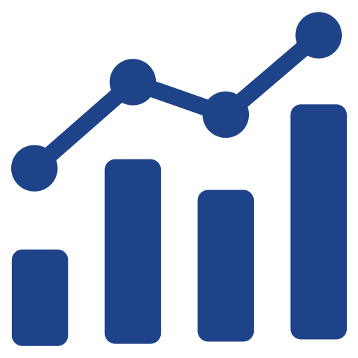
Taking an average of the two proportions is justifiable in this instance as there is a strong linear correlation between the two variables (as illustrated in the chart below). Both variables also have similar distributions, which is discussed in the technical report available via the SEISA resources page.
As the comparability report highlights, the questions on qualifications are broadly comparable, whilst they are highly comparable in the case of occupation.
The highly linear correlation between the two variables we use to create our measure means that even if we only used the occupation variable to generate a measure of deprivation (i.e. we rely upon the most comparable variable), similar results/conclusions would be reached as with our current methodology.
The correlation between qualifications and occupation in small areas of the UK

 9: Can you illustrate how you created your measure with an example?
Yes, please see the example provided in the 'See the data' section.
Let us assume there are just 10 of these small areas from the Census.
The proportion of residents with below degree-level qualifications (Qualifications) and the proportion of residents not working in professional/managerial occupations (Occupation) is firstly calculated in each area alongside the average of these two values. As they are percentages, their value will always range between 0 and 100. A hypothetical table is provided below.
|
Area |
Qualifications (%) |
Occupation (%) |
Average (%) |
|---|---|---|---|
|
Area 1 |
64 |
62 |
63 |
|
Area 2 |
46 |
50 |
48 |
|
Area 3 |
76 |
74 |
75 |
|
Area 4 |
89 |
91 |
90 |
|
Area 5 |
44 |
42 |
43 |
|
Area 6 |
23 |
25 |
24 |
|
Area 7 |
19 |
15 |
17 |
|
Area 8 |
32 |
36 |
34 |
|
Area 9 |
38 |
40 |
39 |
|
Area 10 |
68 |
72 |
70 |
Having completed this first phase, the next step is to proceed only with the area name/code and ‘Average’ column.
|
Area |
Average (%) |
|---|---|
|
Area 1 |
63 |
|
Area 2 |
48 |
|
Area 3 |
75 |
|
Area 4 |
90 |
|
Area 5 |
43 |
|
Area 6 |
24 |
|
Area 7 |
17 |
|
Area 8 |
34 |
|
Area 9 |
39 |
|
Area 10 |
70 |
These areas are then ranked based on the ‘Average’ column from largest to smallest, with areas then assigned their appropriate decile based on their ranking.
|
Area |
Decile |
Average (%) |
|---|---|---|
|
Area 4 |
Decile 1 |
90 |
|
Area 3 |
Decile 2 |
75 |
|
Area 10 |
Decile 3 |
70 |
|
Area 1 |
Decile 4 |
63 |
|
Area 2 |
Decile 5 |
48 |
|
Area 5 |
Decile 6 |
43 |
|
Area 9 |
Decile 7 |
39 |
|
Area 8 |
Decile 8 |
34 |
|
Area 6 |
Decile 9 |
24 |
|
Area 7 |
Decile 10 |
17 |
Through our research, we illustrate that having lower levels of qualification and working outside of professional/managerial roles are both factors that raise the probability of being in deprived circumstances (e.g. by being more likely to have low levels of income).
It is for this reason that higher percentages would indicate that an area is more deprived and therefore should be allocated to a lower decile.
When you select particular areas in our interactive maps or download the 'SEISA dataset' from the 'SEISA resources' webpage, you will be provided with this average percentage (referred to as the ‘SEISA proportion’) and the corresponding decile (both on a UK-wide basis and country-specific level).
Further information on why there are both UK-wide and country-specific deciles is supplied in the expanding box underneath the maps for each nation and also in the cover sheet of the ‘SEISA dataset’ excel file.

10: How did you validate that your measure does proxy for deprivation?
Households/Individuals are more likely to experience deprivation if;
- They have a low income.
- They live in social housing.
- They are part of single parent families.
- They have bad/very bad health.
Using area-level household income estimates in England and Wales from 2011/12 (which take into account family composition and housing costs), we illustrate that the areas we identify as being most deprived in our measure also have, on average, the lowest incomes.
We also demonstrate using Census data that those areas that are within the lowest deciles of our measure have a;
- Higher average proportion of households living in social accommodation.
- Higher average proportion of single parent households.
- Higher average proportion of residents in bad/very bad health.
The relevant charts can be found in the ‘See the data’ section.
[Please note that, to the best of our knowledge, equivalent income estimates for 2011/12 are not available in Scotland and Northern Ireland.]
We highlight the association between our measure of deprivation and household income/housing tenure/family composition/health through a series of charts below.
Please note that we have used country-specific deciles for assessing the correlation between SEISA and income in England (‘SEISA decile England’) and Wales (‘SEISA decile Wales’). For the figures on the association between SEISA and housing tenure/family composition/health, we use UK-wide deciles (‘SEISA decile UK’), given these are based on a UK-wide analysis.
Correlation between SEISA and 2011/12 equivalised income estimates (after housing costs) in England
 in England.svg)
Correlation between SEISA and 2011/12 equivalised income estimates (after housing costs) in Wales
 in Wales.svg)
The association between SEISA and housing tenure

The association between SEISA and family composition

The association between SEISA and self-reported health

 11: You have used the 2011 Census to create this measure. Given the age of the data, is it still useful today?
We have used the latest area-level household income estimates in England/Wales (these are for 2020 and take into account family composition/housing costs) and assessed how this correlates with our measure.
The findings illustrate that the small areas in the most deprived deciles of our measure continue to have the lowest average incomes based on 2020 financial data.
The relevant charts can be found in the ‘See the data’ section.
[Please note that, to the best of our knowledge, equivalent income estimates for 2011/12 are not available in Scotland and Northern Ireland.]
As can be seen from the charts below, the association is very similar to the one observed for 2011/12 income data. This suggests that the measure is still valid to use today.
Please note that we have used country-specific deciles for assessing the correlation between SEISA and income in England (‘SEISA decile England’) and Wales (‘SEISA decile Wales’).
Correlation between SEISA and 2020 equivalised income estimates (after housing costs) in England
 in England.svg)
Correlation between SEISA and 2020 equivalised income estimates (after housing costs) in Wales
 in Wales.svg)
12: How does your measure compare to other area-based measures?
Table 1: A summary of key area-based measures
| Name | UK-wide? | Area or individual-based measure | Size of areas | Measure of (relative) deprivation |
|---|---|---|---|---|
| Socioeconomic Index for Small Areas (SEISA) | Yes | Area | Typically less than 500 residents.
They contain 125 households in England and Wales (on average), between 20 to 78 households in Scotland and 160 households (on average) in Northern Ireland. |
Yes |
| Index of Multiple Deprivation (IMD) | No - England only | Area | Between 1,000 and 3,000 residents | Yes |
| Income Deprivation Affecting Children Index (IDACI) | No - England only | Area | Between 1,000 and 3,000 residents | Yes |
| Welsh Index of Multiple Deprivation (WIMD) | No - Wales only | Area | Between 1,000 and 3,000 residents | Yes |
| Scottish Index of Multiple Deprivation (SIMD) | No - Scotland only | Area | Between 500 and 1,000 residents | Yes |
| Northern Ireland Multiple Deprivation Measure (NIMDM) | No - Northern Ireland only | Area | Between 300 and 6,000 residents | Yes |
| Participation of Local Areas (POLAR) | Yes | Area | Between 5,000 and 15,000 residents in England and Wales, 2,500 and 6,000 residents in Scotland and 300 to 6,000 residents in Northern Ireland | No - classifies areas based on young participation rates in higher education |
| Tracking under-representation by area (TUNDRA) | No - England only | Area | Between 1,000 and 3,000 residents | No - classifies areas based on young participation rates in higher education |
Table 2: Comparing the bottom quintile of SEISA with the bottom quintile of the Indices of Deprivation
| England (IMD) | Wales (WIMD) | Scotland (SIMD) | Northern Ireland (NIMDM) |
|---|---|---|---|
| SEISA picks up a greater proportion of rural areas | SEISA picks up a greater proportion of rural areas | SEISA picks up a greater proportion of rural areas |
SEISA picks up an almost equivalent proportion of rural areas. |
| SEISA captures a larger proportion of (medium/large) towns and cities (particularly in northern and central England) | SEISA picks up more areas in parts of south Wales (specifically Rhondda and Caerphilly) | Bottom quintile of SEISA captures all council areas of Scotland, including Na h-Eileanan an Iar, as well as Shetland and the Orkney Islands | SEISA more likely to pick up areas in northern and/or eastern parts of the country |
 13: How do you anticipate the measure being used?
- To support widening participation work in the higher education sector.
- By HESA in research and official statistics outputs.
- By individuals/organisations who need data on deprivation to support their decision-making processes.
- By individuals/organisations who carry out research/analysis on this matter.
Further details on how the measure can be used are provided in the ‘Read more’ section.
In the higher education sector, we expect that the measure will be used to support widening participation activity, though we leave it to providers to choose how they wish to apply it in their work.
HESA will be looking to apply this measure in our research and official statistics outputs (e.g. when examining inequalities in the higher education sector and how these differ by nation).
As with the Indices of Deprivation in each nation, our measure may be of benefit to individuals/organisations who need data on deprivation to support their decision-making processes, as well as those who carry out research/analysis on this matter. This may include those in;
- Other parts of the education sector.
- National Government (e.g. in allocating funding towards the most deprived areas).
- Local Government (e.g. in determining where to target particular programmes/interventions).
- Healthcare (e.g. in exploring health inequalities).
- Charities/researchers/other organisations specialising in issues relating to poverty and deprivation.

14: What can the measure not be used for?
Our measure attempts to capture relative deprivation and thus can be used to identify the most deprived parts of the country.
However, as with the Indices of Deprivation, it is not in itself a direct measure of deprivation.
Rather, we have had to use variables contained within the Census that may allow us to formulate a measure that is likely to be highly associated with deprivation.
It cannot be used by a user to therefore quantify by how much one area is more/less deprived than another.
Furthermore, as it is an area-based measure, it cannot tell us anything about how deprived a person/household is.
That is, there could be households who themselves are not deprived, despite living in an area that is classified as being highly deprived.
Equally, there may be households experiencing multiple forms of deprivation who live in localities that are deemed to be less deprived.
 15: How can I access this data to support my own work?
- There is an option to download the data directly from the maps/postcode search tool.
- Separately to the maps, there is a file containing the small area (‘output area’) code, the SEISA proportion and corresponding SEISA deciles (both at a UK-wide level and on a country-specific basis).
- The data can be requested as part of a HESA data extract purchased through the Jisc Data Analytics team.
Should you use our data in a published report/research paper, we would be grateful if you could acknowledge this through the following reference;
Higher Education Statistics Agency (2024). ‘Socioeconomic Index for Small Areas’. Available at https://www.hesa.ac.uk/data-and-analysis/research/seisa
Further details on how the data can be accessed are available in the ‘Read more’ section.
Firstly, the data has been presented as part of an interactive map/postcode search tool, which can be accessed in this section of our website. You will see that beneath the maps, we provide a table of data that relates to the area you search for. This can be downloaded.
Further information on how to do so is supplied in our instructions/user guide that accompanies the maps/postcode search tool.
Secondly, separately to the maps, we have provided an excel file containing the small area (‘output area’) code, SEISA proportion and corresponding deciles (both at a UK-wide level and on a country-specific basis).
If you do not have small area (‘output area’) codes in your dataset, but do have the postcode, you can map postcodes to output areas using lookup files supplied by the Office for National Statistics. This will then provide an avenue through which to link to our own deprivation data. Please be aware of the license terms and conditions if you choose to use postcode products.
Finally, if you are asking for an extract of HESA data through the Jisc Data Analytics team, users can now request the SEISA proportion and corresponding decile (this can be the UK-wide and/or country-specific deciles depending on the nature of your analysis) as part of their request.

16: Do you provide data on other area-based measures, such as the Indices of Deprivation, alongside your own?
We were unable to incorporate other area-based measures into our interactive map/postcode search tool.
The reason for this is that the volume of data resulted in the maps becoming very slow.
However, we have provided an excel file containing all the variables we used in the production of our technical report. This has been supplied to follow best practice, whereby others are able to replicate our key findings.
More information on this file can be found in the ‘Read more’ section.
In this file, users will find data on the Indices of Deprivation for each nation, TUNDRA and the 2011/12 area-level income estimates for England/Wales that we discuss above, alongside the key Census variables we use in creating/validating our measure.
While users are also welcome to utilise this for their own research purposes, this is a static file and will not be updated any further (e.g. if there were to be revisions made to the Indices of Deprivation).

Statistician
Siobhan Donnelly
Archie Bye
SEISA pages
- SEISA homepage
- SEISA summary
- 1: Defining deprivation and poverty
- 2: Why deprivation matters
- 3: What data is available on deprivation levels in the country?
- 4: What are the limitations of the Indices of Deprivation?
- 5: Why did HESA create a new area-based measure of deprivation?
- 6: What data source did HESA use to generate a new area-based measure of deprivation?
- 7: What are the key benefits of using the Census?
- 8: How did you produce your measure?
- 9: Can you illustrate how you created your measure with an example?
- 10: How did you validate that your measure does proxy for deprivation?
- 11: You have used the 2011 Census to create this measure. Given the age of the data, is it still useful today?
- 12: How does your measure compare to other area-based measures?
- 13: How do you anticipate the measure being used?
- 14: What can the measure not be used for?
- 15: How can I access this data to support my own work?
- 16: Do you provide data on other area-based measures, such as the Indices of Deprivation, alongside your own?
- 17: Will you be updating your measure with Census 2021 data?
- England map
- Wales map
- Scotland map
- Northern Ireland map
- SEISA resources
Feedback
Please email [email protected] with comments on this experimental statistics release
Press enquiries
+44 (0)1242 388 513 [option 6], [email protected]